

History of the castle
GYIMES CASTLE “IN THE PASSING OF TIME”
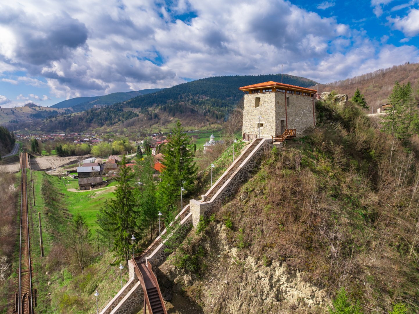
In the picturesque surroundings of the Gyimes Pass, towering above one of the characteristic bends of the Tatros River, the Bethlen–Rákóczi Castle of Gyimesbükk rises atop the rocky outcrop known as Kő-orr. In 18th-century sources, this hill was still referred to as Áldomás Hill.
1619
Article 5 of the May Diet of Gyulafehérvár, concerning the border passes, reveals that there was no castle in the Gyimes Pass at that time.
1626
The Gyimes Castle was built by Gábor Bethlen, Prince of Transylvania (1613–1629). Historical tradition dates the construction of the fortress to 1626, or more precisely its completion, based on the authentic autobiography of his contemporary, György Tatrosy. The castle of ‘Csikhavas’ mentioned in Tatrosy’s account can be identified with the castle of Gyimes. Based on other historical sources – such as the autobiography of János Kemény, a later Prince of Transylvania – it can also be established that the castle was indeed built in the 1620s. Its construction was linked to the strengthening of the borders and the intensification of road controls; at that time, castles were built not only in the Gyimes Pass but also at other strategic eastern and south-eastern passes in Transylvania.
György Tatrosy: “From the direction of the two Wallachian lands, His Majesty our Lord had four fine defensive castles built at once in the snowy passes of Csíkhavas, Oytoz, Dofftan, and Boza” (From the two Wallachian regions, His Majesty had four strong defensive castles built in the snowy passes of Csíkhavas, the Oytoz Pass, the Doftán Pass and the Boz Pass.)
The financial burden of the castle constructions was borne mainly by the Székely seats (administrative units), as we learn from the minutes of the 1626 and 1630 Diets of Gyulafehérvár.
From a military point of view, the castle at Gyimes was not considered a significant fortification; its function was to control the valley pass and to levy taxes on passing trade, that is, to collect customs duties.
7 June 1634
A record mentioned the name of the fortification for the first time in connection with the fact that ‘at the Gyimes fortress’, that is, at Gyimes Castle, Bálint Lőrincz and his garrison were on guard duty at that time.
Mid-17th century
According to tradition, in the mid-17th century, Prince György Rákóczi I or II of Transylvania ordered further fortifications to be carried out on the stronghold, which is why it may have come to be known as “Rákóczi Castle”.
In 1677, it was recorded that in peacetime, two soldiers stood guard at the thirty-percent tollhouse operating in Gyimes Castle, whilst at other times their number increased depending on the situation. A source from 1681 tells us that in the event of war, ten men stood guard at the fortress.
From 1690, under the Diploma Leopoldinum, the document issued by Leopold I, Holy Roman Emperor and King of Hungary, (issued in 1691), the Grand Principality of Transylvania became part of the Habsburg Empire; the importance of guarding the borders increased further, and whilst the castle retained its previous function, its role was expanded.
14 February 1694
Turkish–Tatar forces invaded Székely Land for the last time in February 1694, crossing the Gyimes Pass. Due to the heavy snow, the surprise attack caught the people of Csík completely unprepared, as the Gyimes fortress was barely guarded.
Following the previous year’s attack, work began in 1695 to reinforce the castle, walls and ramparts; the works continued into 1698, but there is also evidence of construction in the Gyimes Pass dating from 1711. As a result, a complex system of fortifications was built up around the castle. In the 18th and 19th centuries, this formed part of the complex system of fortifications and quarantine stations that protected the border between Transylvania and Moldavia from enemy incursions and the spread of the plague. A quarantine station—referred to in the period as a ‘quarantine post’ or ‘health inspection house’—was also established here, where people had to remain for several weeks so that any illnesses they might be carrying could be detected before they entered the country.
1712
According to an inscription in Armenian scratched onto the north wall of the so-called ‘Kontumáci Chapel’ in Gyimes, the quarantine station building in Gyimes already existed at this time, the inscription, which emerged from beneath later plaster, and the associated date of 1712 (MDCCXII) were noticed by parish priest József Salamon in 2008 during renovation work on the chapel. Presumably, the chapel was later created by extending one of the original quarantine buildings.
1718
Austrian military maps depicting the Gyimes Pass provide information on the condition and development of the fortification system in the 18th and 19th centuries; these are preserved in the Austrian State Archives – War Archives (Österreichisches Staatsarchiv – Kriegsarchiv) in Vienna. The earliest surviving map dates from 1718; thanks to earlier construction work, the fortress already bore the hallmarks of the Habsburg Empire’s standardised mountain fortifications and was marked as a ‘Blockhaus’.
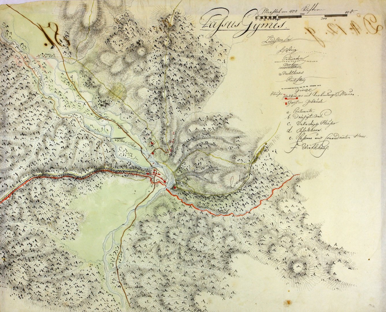
At the time the 1733 military map was drawn up, the castle was a rectangular, tower-like structure marked with the letter C, which was recorded as being in a state of ruin and had previously been used as a gunpowder store. To the east of this, a tower was marked on each side of the Tatros River; the remains of the square tower marked A and the pentagonal tower marked B can be seen on the map. A ruined, wall with embrasures, surrounded by trenches, ran down the mountainside all the way to the fort marked B, from where a ruined palisade stretched to the River Tatros and then beyond to the fort marked A, forming a physical barrier against unauthorised passage.
A drawing of the Gyimes Pass from 1735 has survived, showing the castle in its ruined state at that time.
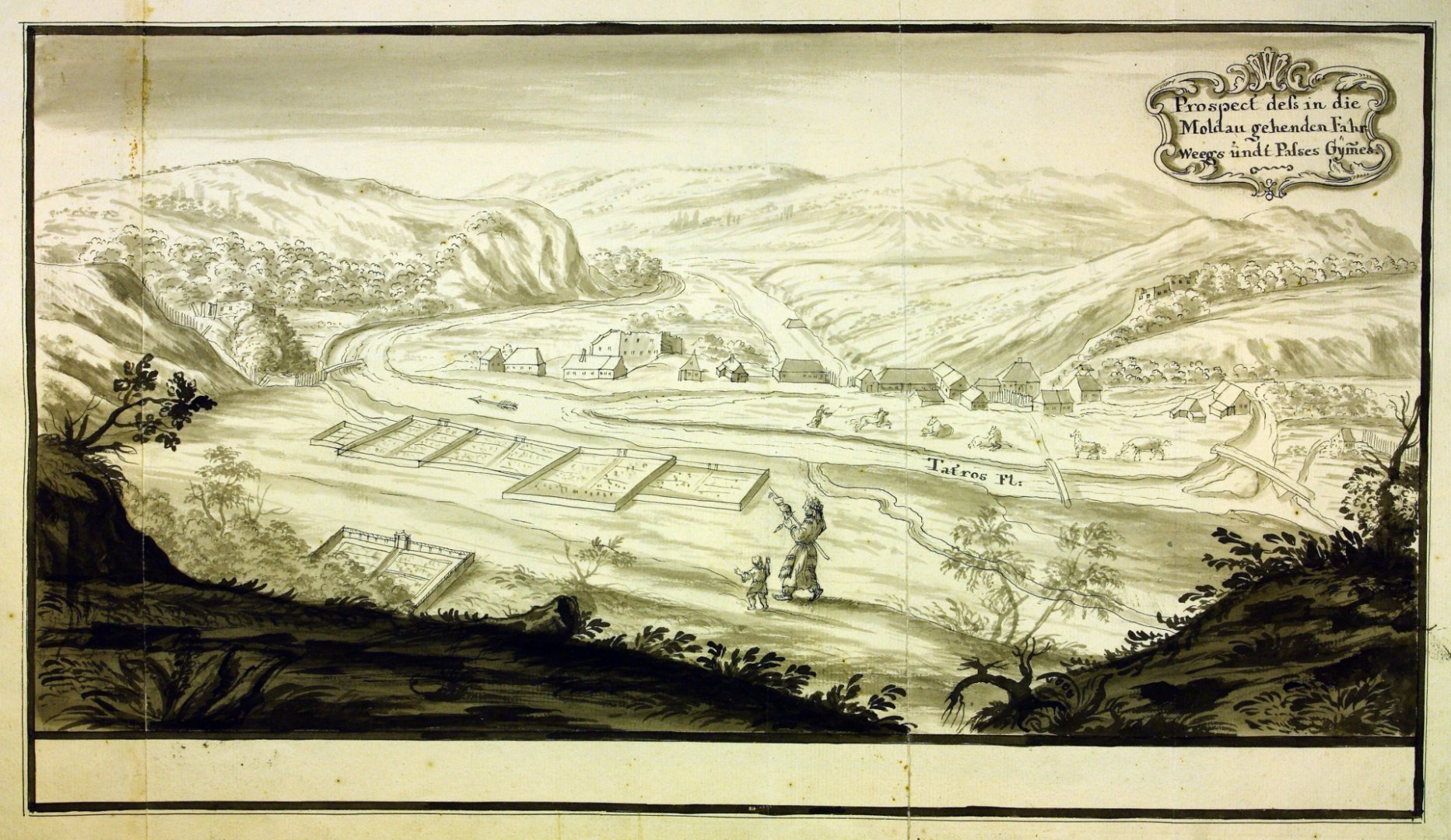
7 January 1764
The Madéfalva crisis: In 1763, the Viennese court ordered that the Szeklers of Transylvania should also establish border regiments modelled on the imperial system; the Szeklers resisted this decree in order to preserve their centuries-old military autonomy and privileges. The Szekler leaders gathered at Madéfalva were attacked by the imperial army at dawn on 7 January 1764; in the operation, which began with heavy cannon fire, women and children were also massacred. As a result of the bloodshed, mass emigration towards Bukovina began.
1768
The 1768 survey already included plan and sectional drawings of the three forts defending the pass; the fort on Gyimes Hill was marked with the letter A, the one on the rampart with B, and the one on Áldomás Hill—that is, the castle—with C. By this time, the fortification had essentially taken its final form; it was a single-storey building with two entrances, the ground-floor entrance on the north-eastern side and the upper-floor entrance in the south-western corner; the latter, due to the building’s construction into the hillside, led to the ridge behind the castle. However, at this stage, both floors consisted of just a single room each.
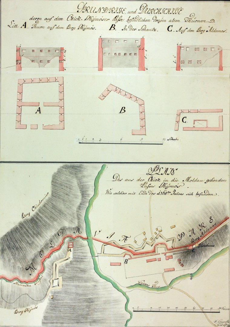
1771
By this time, the castle, which had been in a state of disrepair, and the adjoining defensive wall blocking the valley had been renovated; the western rampart had been rebuilt, and the southern rampart had been extended westwards. In connection with the latter, a small building was erected not far from the south-western corner of the castle. At this time, a detailed site plan was drawn up of the Gyimes Pass, showing the fortification system, the military and customs buildings, as well as the houses of the local population who had settled there and populated the area around the pass during the reign of Maria Theresa.
A map from 1780–1781 also shows the pass’s new ramparts and new palisade, that is, its walls made of stakes. At the north-eastern corner of the fortress, a closed defensive corridor was marked, leading down into the valley along the valley-blocking wall, which, continuing on and then continuing as a palisade wall, connected the three forts of the pass. On this map, numerous buildings were already marked on the Moldavian side of the valley-blocking wall.
12 July 1788
On this day, during the Habsburg–Turkish War, the Gyimes fortification system had to repel a serious attack for the first time. Some two thousand Turkish soldiers stormed the defensive line, but were eventually repelled and were unable to penetrate the country’s territory.
1789
András Lacz, a Szekler hussar, rode up the 134 steps to the castle.
1791
According to a highly detailed site plan from 1791, the defensive system had already been rebuilt, but the map also shows the four additional earthworks erected in 1788, at the outbreak of the Habsburg–Turkish War, to reinforce the defences. The fortification at the western end of Áldomás Hill was also marked – to which a cannon road led along the ridge of the hill – and on the site of which a ‘Blockhaus’ had already stood before 1733, though it was mentioned at that time as having been destroyed.
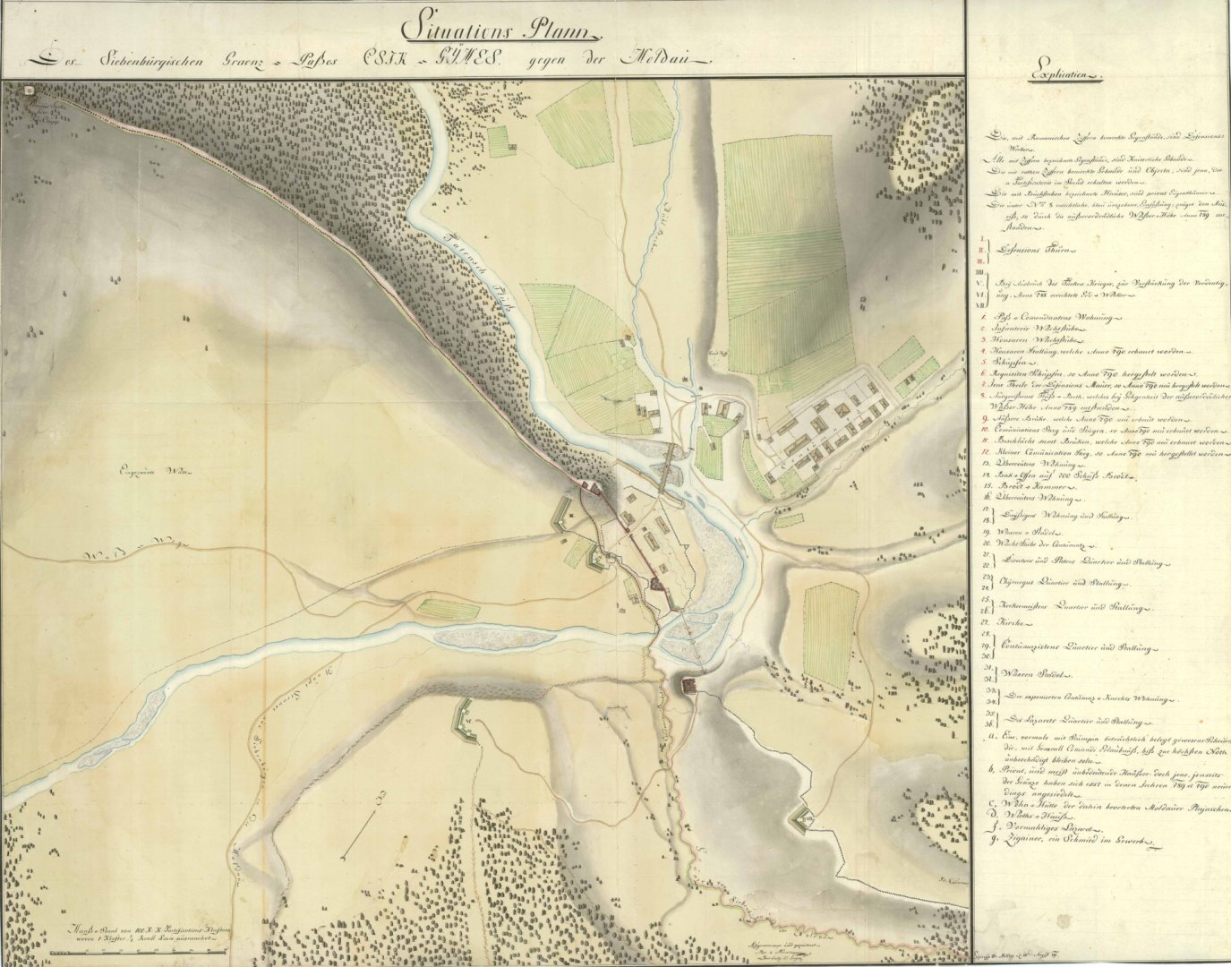
1843–1860s
construction of an embankment for the main road from Csíkszépvíz, winding through Szermász towards Gyimes to the border.
1848
Following the revolution, under the April Laws, Transylvania (the Grand Principality of Transylvania) – and with it the Gyimes Valley – once again became part of Hungary (the Kingdom of Hungary).
1854
Detailed survey drawings of the fortification system were produced at this time, essentially reflecting the state of affairs as it had developed in the 18th century, including floor plans, elevation drawings and cross-sections, showing doors and windows. However, according to the overview plan, the system already consisted of five forts; by this time, two new ones had been erected from beams on the eastern side. The border gate structure was defended by two cannons. Within the fortress, movement between the levels took place via a staircase constructed in the north-western corner. On both levels, one larger room was marked on the east side and one smaller room on the west side – next to the staircase. The upper floor was heated; a stove was also indicated here.
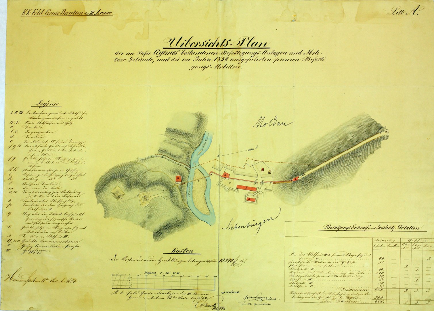
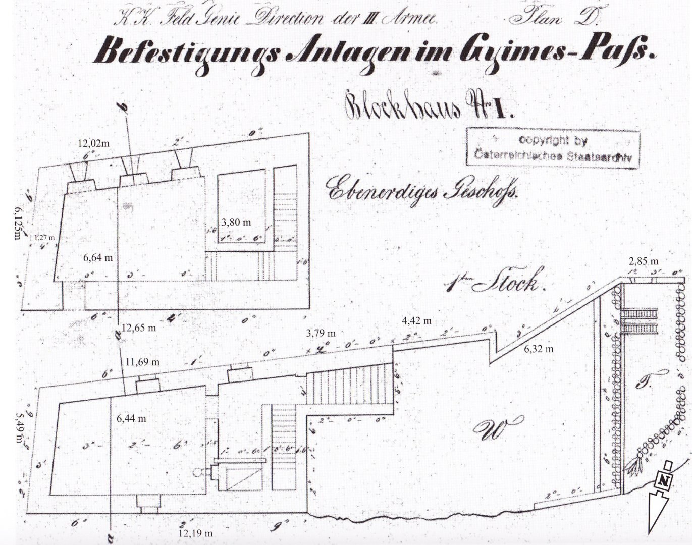
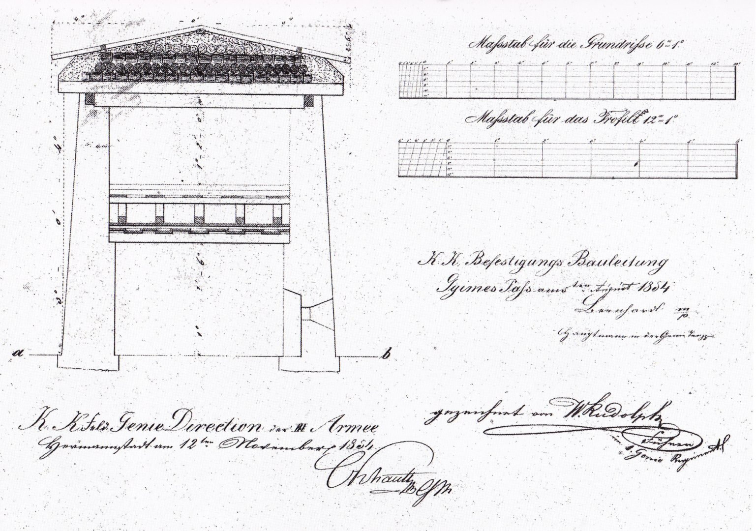
Second half of the 19th century: archaeological research indicates that a small room was added to the western end of the castle, the walls of which were connected to the western end wall and the northern wall of the staircase leading up to the ridge.
1873
The institution of the garrison was abolished.
1876
Floor plans and a cross-section of the castle’s two levels have survived from this year, which essentially corresponded to the 1854 depictions. It appears that the cross-section depicted the castle at this time without a roof and without the floor separating the two levels. As a large-scale fortification programme was launched in the border region at this time to strengthen defences, it is possible that the castle was rebuilt.
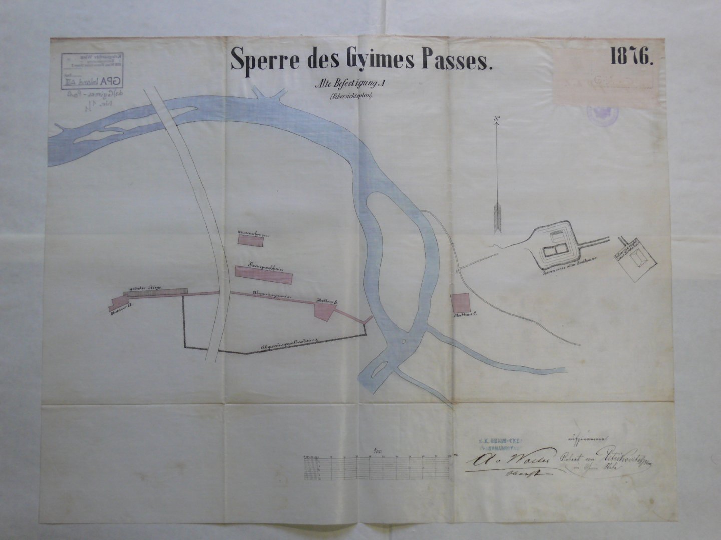
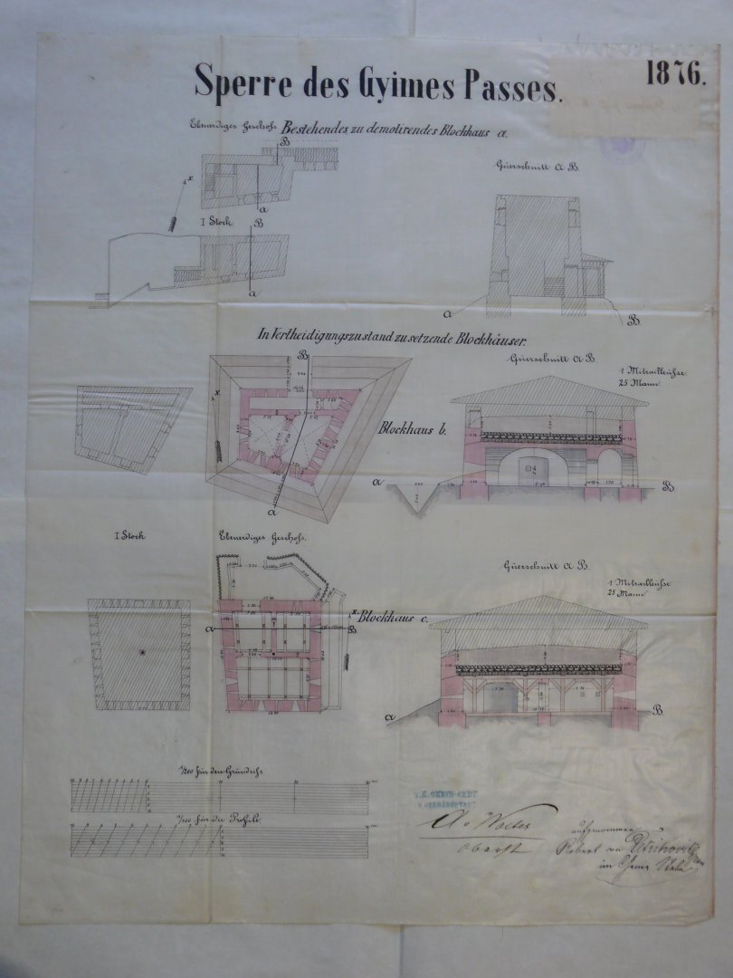
1878
As part of the fortification programme, two new forts had been built by this time to the north-east of the Gyimes crossing, and the fortification at the western end of Áldomás Hill had been rebuilt, bringing the total number of units in the defence system to eight.

1894
Hungary and Romania decided to build a new railway line through the Gyimes Valley.
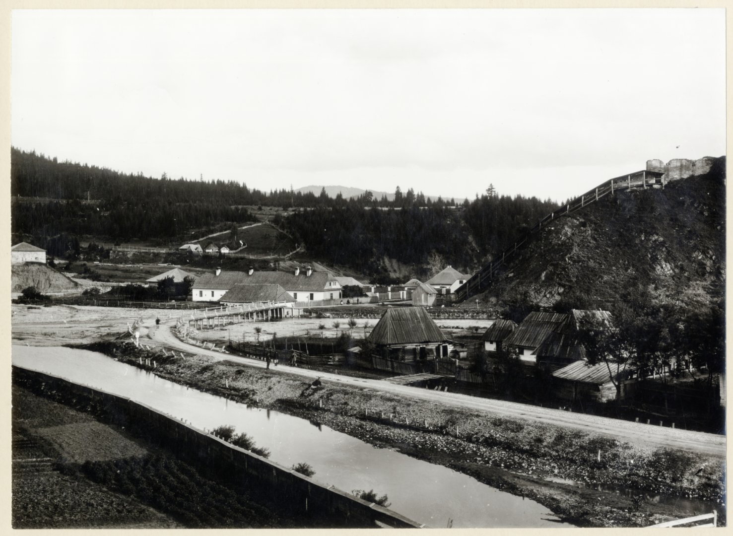
From 1896 onwards, photographs were also taken of the castle’s condition at that time. They show the high-standing ruins of the burnt-out fortification and the valley-blocking wall with the enclosed defensive passage running alongside it, in which 134 steps led up to the castle at that time. Although the 1876 floor plan did not show any windows on either the ground floor or the upper floor on the eastern side, the photographs show a single window in the centre of each level.
18 October 1897
The railway opened on the Hungarian side. A 15-metre-long cut had to be made beneath the castle hill to route the railway line; in the process, the old staircase leading to the fortification and the protective corridor were demolished, and in their place a new, steeper flight of steps with a 96-degree angle was built by 1900. In 1896–97, the Hungarian State Railways’ former easternmost signal box, Signal Box No. 30, was built a few metres from the border.
5 April 1899
The railway opened on the Romanian side as well, and train services between the two countries began.
In the 20th century, the castle fell into disrepair and its ruins were filled in.
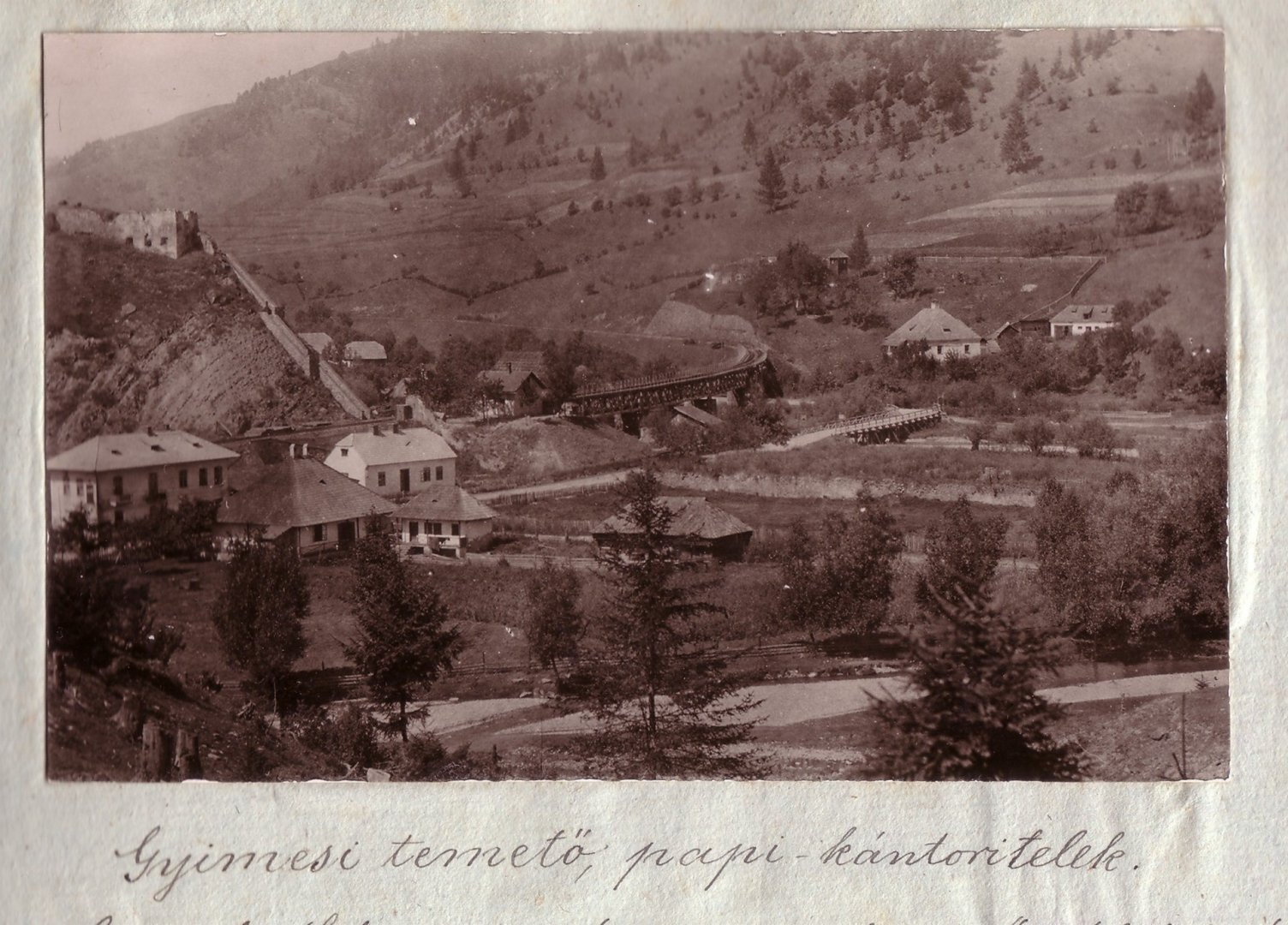
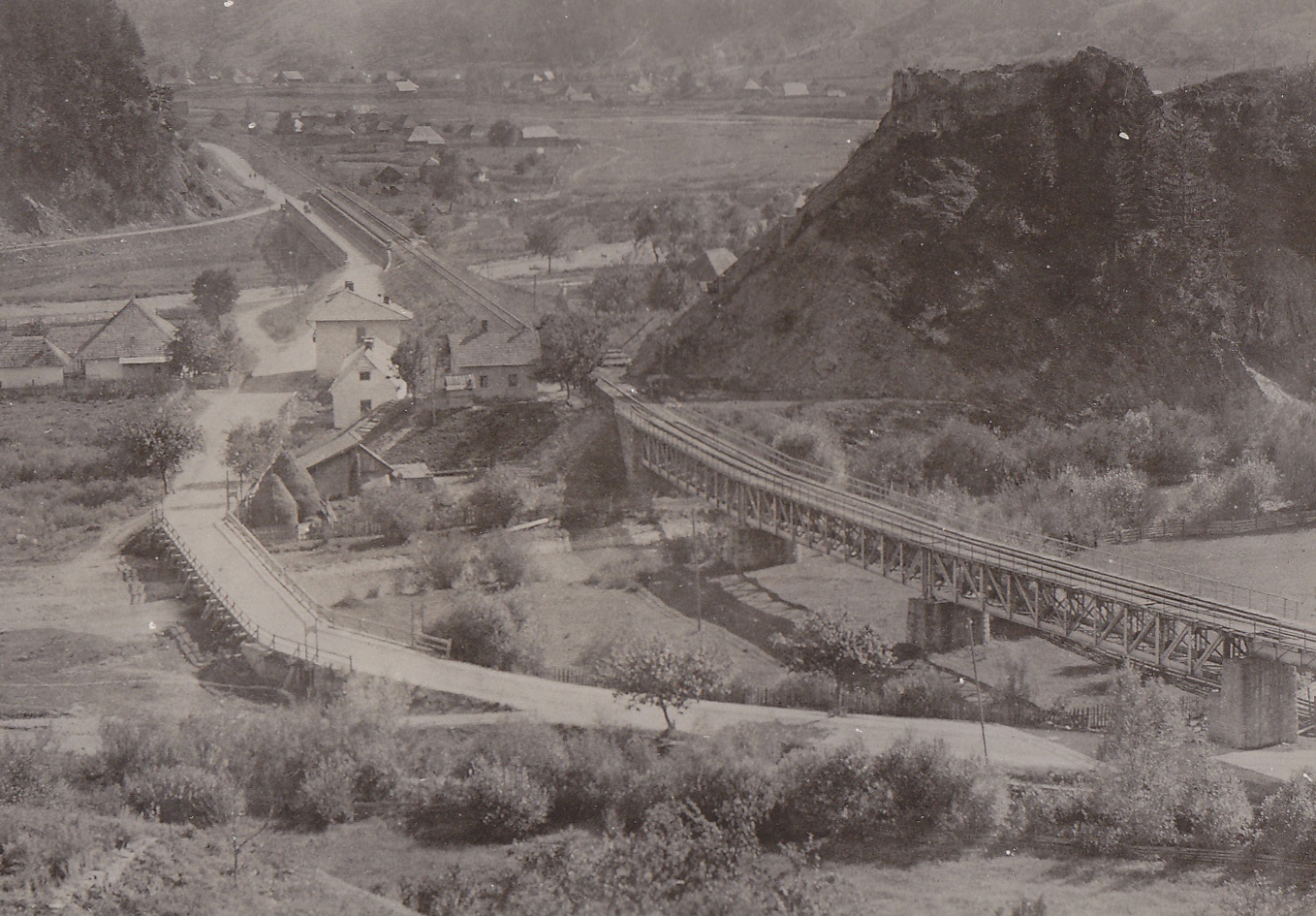

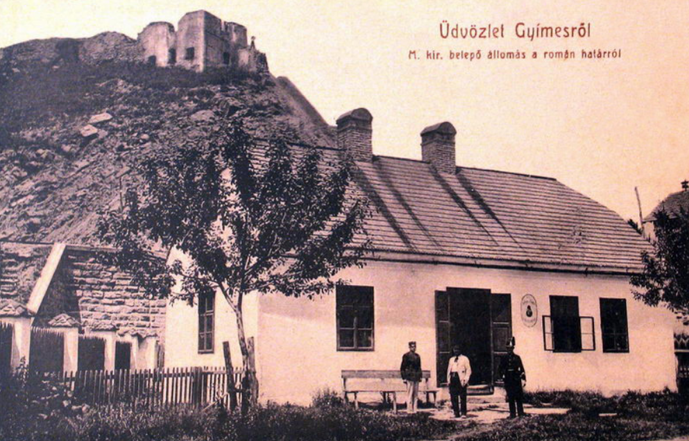
Gyimesbükk was part of historic Hungary until 1920, then, following the Treaty of Trianon, it was ceded to Romania along with Transylvania.
In 1940, under the Second Vienna Award, Gyimesbükk was annexed to Hungary.
In 1945, following the Second World War, the area was returned to Romania.
Following archaeological research that began in 2015, the castle at Gyimesbükk was rebuilt from its ruins in 2024–2025 based on the original survey plans held in the Vienna Military Archives.
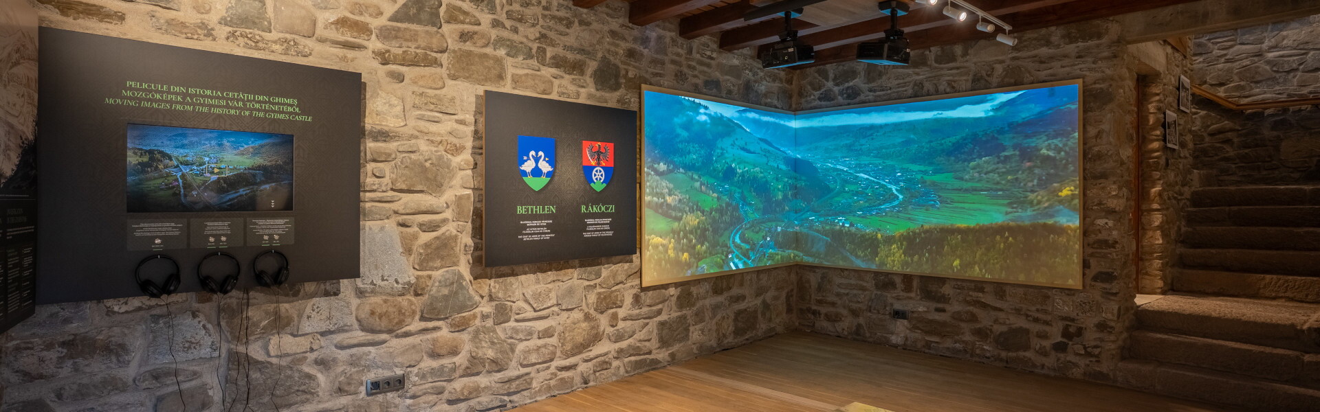
In 2025, work began on developing the castle into a tourist attraction, and in 2026 – on the 400th anniversary of the castle’s construction – the Bethlen–Rákóczi Castle exhibition opened.